NYC header
 

June 9, 2022 update: New York City version of Redistricting & You launched; helps bring transparency to this year's NYC Council districting process

The CUNY Graduate Center has launched a local version of its helpful New York: Redistricting & You online map in New York City, focused on City Council districting: Redistricting & You: NYC. This effort is supported by the Fund for the City of New York.

For now, the NYC Districting Commission has delayed the release of its first proposed plan for new council districts to obtain additional public input, so Redistricting & You: NYC only shows current districts (see example below). Once the Commission publishes a proposal, and/or if outside stakeholders submit plans, we will add them to the website for easy comparison with current lines.

NYC Redistricting You online map screenshot

Click to view map

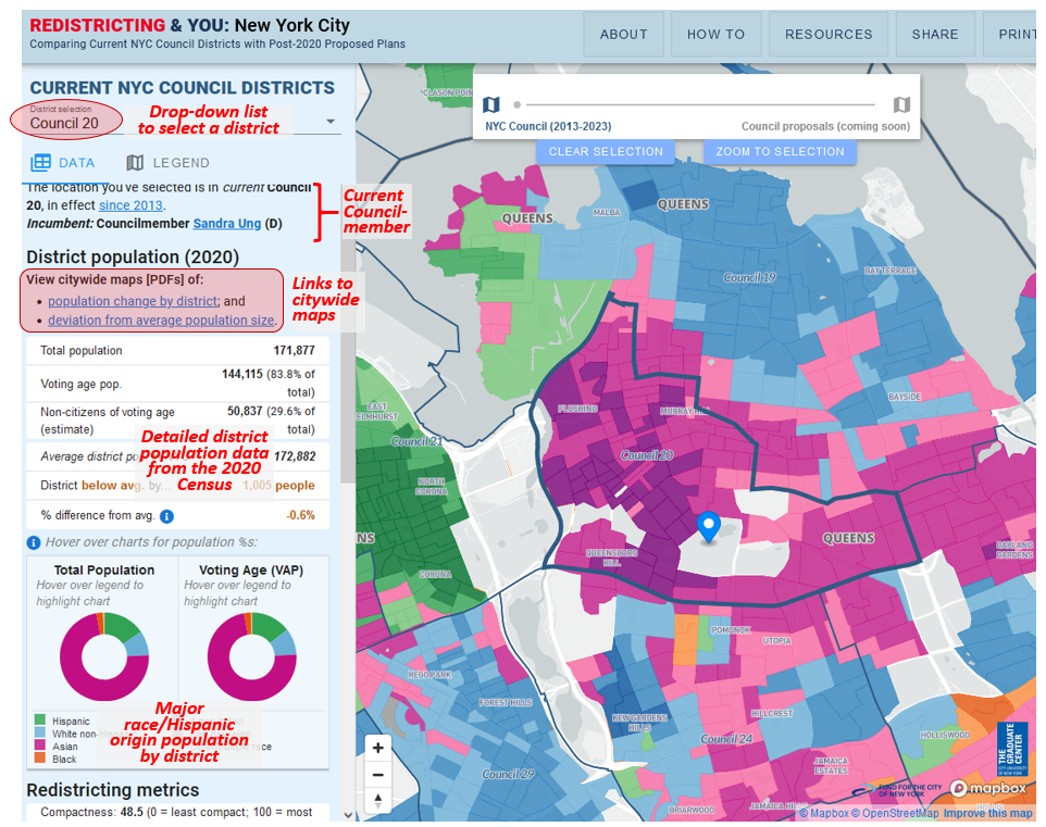
District population & demographics

For each current Council district, Redistricting & You: NYC displays helpful information for stakeholders who want to learn more and participate in the districting process, such as:
* current councilmember's name and party affiliation, with a link to the district's profile at the NYC Council website;
* district-level population data such as overall & voting age population (from the 2020 Census), estimated non-citizens of voting age (per the 2016-2020 American Community Survey), and deviation from average district population size;
* pie charts showing population distribution by race/Hispanic origin as indicated in the 2020 Census (for overall population and voting age population); and
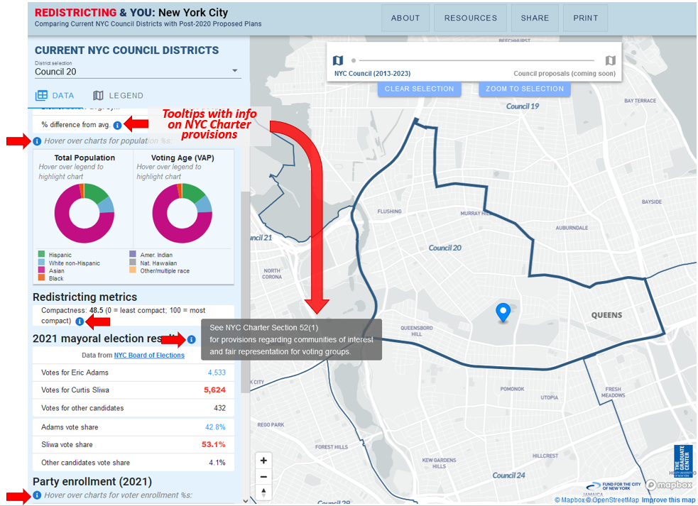
* party enrollment and vote results from the 2021 general election for mayor, by council district.

The image below highlights each section of Redistricting & You: NYC where you can access this information.

NYC Redistricting You online map demographics

Click to enlarge image

NYC Charter provisions highlighted on map

Each of the details in the side panel at Redistricting & You: NYC is related to one or more provisions of the NYC Charter that govern the city council districting process.

Specific Charter provisions are displayed when you move your mouse over each "info icon" in the side panel (see annotated screenshot below).

For example, the info icon in the Redistricting Metrics section reveals that Section 52(1)(d) of the Charter states that "Each district shall be compact and shall be no more than twice as long as it is wide."

screenshot chartertooltips

Click to enlarge image

Citywide views of population change by district, & deviation from average district size

The maps below display citywide patterns by City Council district of population change between 2010 and 2020 (map on the left), and population deviation from the citywide average district size (map on right).

These patterns provide an initial indication of how current district lines may need to change to reflect the redistricting principle that districts should be as close to equal population as possible.

NYC CC pop change 2010 2020

Click to view map [PDF]

NYC CC pop deviation

Click to view map [PDF]

Send us feedback

Please send us any feedback or suggestions for making the maps more useful. Thanks!


Powered by Mad Mimi®A GoDaddy® company